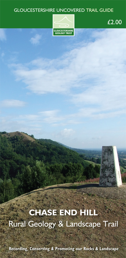
| Chase End Hill - Geology and Landscape Trail This trail follows a route over Chase End Hill, the southernmost outcrop of the Malvern Hills, into the valley at Whiteleaved Oak and on to towards the village of Bromsberrow. Along the way you will visit an old quarry in the metamorphic rocks of the Malverns Complex and enjoy stunning views all around from the top of Chase End Hill. The Whiteleaved Oak Shale and Bronsil Shale have been baked by igneous intrusions which are seen in a small secluded old quarry, and rocks derived from erosion of the mountains which are now the Malvern Hills are seen beside the road to Bromsberrow. A sunken lane demonstrates desert sandstones, before returning to the start over beautiful parkland. £2.00 To purchase any of our publications, please send us a cheque for guide and postage to our address listed on our Contact Page, with your address for us to send the guide. Alternatively email us at info@glosgeotrust.org.uk to arrange. << Back |
 Click thumbnail to enlarge |

| Gloucestershire Geoconservation Trust. Registered Charity Number: 1115272. © 2024 All Rights Reserved. |